Slovenian Environment Agency, Seismology Office (ARSO)
Contact information
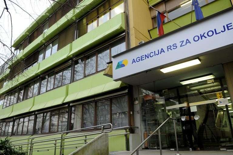
Vojkova 1b, SI-1000 Ljubljana, Slovenia
E-mail: seismo.lju@gov.si
Phone: +386 1 478 4000
Webpage: https://potresi.arso.gov.si/
Facebook: ARSO potresi
Twitter: @ARSO_potresi
Contact person: Martina Čarman (Martina.Carman@gov.si)
Slovenian Environment Agency, Seismology Office is responsible for:
a) Seismological monitoring in Slovenia, processing and analyses of seismological data and communication on earthquake parameters to civil protection organizations, public and media,
b) Collection and analyses of earthquake effects data and determination of seismic intensities,
c) Seismic hazard assessment for the whole country and for critical infrastructure, and
d) research and development in the field of seismology and international seismological cooperation.
ARSO joined EPOS Slovenia in 2016.
Research
Within EPOS, ARSO is a member of Thematic Core for Seismology (TCS Seismology) consortium. ARSO cooperates with infrastructure, data and knowledge in three areas. Currently, ARSO forwards data in real time of seismic stations of the national network to EPOS via ORFEUS (Observatories & Research Facilities for European Seismology) and at the same time, it acquires data of foreign seismic stations on daily bases. ARSO sends basic parametric earthquake information products to EPOS via EMSC (European-Mediterranean Seismological Center) and AHEAD (European Archive of Historical Earthquake Data). The input data for the earthquake hazard assessment and it’s results are coordinated within the EFEHR (European Facilities for Earthquake Hazard and Risk). ARSO also uses various seismology-related services available on the EPOS platform. In addition to seismograms, ARSO also uses seismograms and products that cover the wider cross-border area of Slovenia for the calculation of earthquake parameters. It acquires them from the EPOS platform. Thus, it can efficiently and quickly inform the public about earthquakes, more precisely determine basic seismic parameters, and use them in earthquake hazard calculations and the interpretation of seismically active segments of faults.
ARSO actively participates in the creation of the FDSN Station Book – the database of seismic stations and measuring equipment – and in the preparation of the collection of seismogenic faults, named EDSF. ARSO regularly updates the data in both collections.
ARSO actively participated in updating the European Earthquake Hazard Map (ESHM20), where it harmonized Slovenian and European (regional) data, models and procedures. At the same time, ARSO (in cooperation with Geološki zavod Slovenije ), taking into account the data and insights from the European project, created a new model of the earthquake hazard of Slovenia and in 2021 issued a new map and related products of the earthquake hazard of Slovenia for planning purposes, as well as a corresponding interpreter and an online viewer of the earthquake hazard.
RI-SI-EPOS project
In the framework of the RI-SI-EPOS project, ARSO studies the seismicity of the wider area of the Pivka basin and the surroundings of Snežnik. The main purpose of the research is the characterization of seismically active tectonic structures in the research area. ARSO fulfils its tasks in three areas: infrastructure, knowledge and seismological output.
Recording the seismicity of the wider area of the Pivka basin and the surroundings of Snežnik is now possible through virtual Slovenian Karst NFO Seismic Network. The network consists of temporary sites – installed in 2020 and equipped with instruments purchased as part of the RI-SI-EPOS project – as well as the permanent and temporary seismic stations of the Seismic network of the Republic of Slovenia, managed by ARSO.
In the framework of the project, ARSO provides seismological knowledge and research of the study area. In the initial phase of the RI-SI-EPOS project, ARSO provides knowledge of measuring technique, which includes the preparation of a project plan for the equipment of an independent temporary measuring site, the selection of measuring equipment, the appropriate preparation of the measuring site and the installation of the equipment in situ. ARSO performs continuous comprehensive collection and archiving of seismic data, monitors the quality of the data, and fixes problems with equipment or IT.
With expert knowledge in the field of seismology, ARSO daily processes seismic records to obtain basic earthquake parameters, such as earthquake location, magnitude, intensity, data on earthquake effects, focal mechanisms, etc. ARSO prepares regular reports on the seismicity in the study area.
In several years of recording earthquakes, we expect to have sufficient quality data and be able to interpret seismicity and characterize seismically active structures in the study area.
The AlpArray programme
The AlpArray programme is a multinational, European consortium to advance our understanding of orogenesis and its relationship to mantle dynamics, plate reorganizations, surface processes and seismic hazard in the Alps–Apennines–Carpathians–Dinarides orogenic system. The AlpArray Seismic Network has been deployed with contributions from 36 institutions from 11 countries to map physical properties of the lithosphere and asthenosphere in 3D and thus to obtain new, high-resolution geophysical images of structures from the surface down to the base of the mantle transition zone. With over 600 broadband stations operated for 2 years, this seismic experiment is one of the largest simultaneously operated seismological networks in the academic domain, employing hexagonal coverage with station spacing at less than 52 km. This dense and regularly spaced experiment is made possible by the coordinated coeval deployment of temporary stations from numerous national pools, including ocean-bottom seismometers, which were funded by different national agencies. They combine with permanent networks, which also required the cooperation of many different operators. Together these stations ultimately fill coverage gaps. Following a short overview of previous large-scale seismological experiments in the Alpine region, we here present the goals, construction, deployment, characteristics and data management of the AlpArray Seismic Network, which will provide data that is expected to be unprecedented in quality to image the complex Alpine mountains at depth (from Hetényi, G., Molinari, I., Clinton, J. et al. The AlpArray Seismic Network: A Large-Scale European Experiment to Image the Alpine Orogen. Surv Geophys 39, 1009–1033 (2018). https://doi.org/10.1007/s10712-018-9472-4).
European Seismic Hazard Model (ESHM20)
Under the cover of EFEHR, the 2020 update of the European Seismic Hazard Model (ESHM20) was developed. It provides an update of the earthquake hazard assessment of the Euro-Mediterranean region. The ESHM20 follows state-of-the art procedures homogeneously applied for the entire pan-European region, without the country-borders issues. The model was built upon recently compiled datasets (i.e. earthquake catalogues, active faults, ground shaking recordings), information (tectonic and geological) and models (seismogenic sources, ground shaking). A fully probabilistic framework was adopted in the hazard model implementation and all datasets and inputs are fully cross-border harmonized. The newly developed seismogenic source model encompasses fully harmonized and cross borders seismogenic sources following the recent national earthquake hazard models. The inherent uncertainties in characterizing the earthquake rupture forecast are handled by a complex logic tree, consisting of two main models (branches): an area source-based model and a hybrid fault-smoothed seismicity model. The ground motion characteristic model is built upon the most complete ground shaking recordings in Europe.
Main reference: Danciu L., Nandan S., Reyes C., Basili R., Weatherill G., Beauval C., Rovida A., Vilanova S., Sesetyan K., Bard P-Y., Cotton F., Wiemer S., Giardini D. (2021) – The 2020 update of the European Seismic Hazard Model: Model Overview. EFEHR Technical Report 001, v1.0.0, https://doi.org/10.12686/a15
ARSO experts participated in meetings and webinars to exchange and harmonize data and models, as well as to enable up-to-date knowledge transfer. In parallel with ESHM20, the Slovenian seismic hazard model and national hazard map were developed for design purposes.
Main reference: Šket Motnikar, B., Zupančič, P., Živčić, M., Atanackov, J., Jamšek Rupnik, P., Čarman, M., Danciu, L., Gosar, A., 2022a. The 2021 seismic hazard model for Slovenia (SHMS21): overview and results. Bull Earthquake Eng (2022). https://doi.org/10.1007/s10518-022-01399-8
RI-SI-EPOS equipment
Publications
Jerše Sharma, A., Jesenko, T., 2025. Potresi v Sloveniji leta 2024. V: T. Jesenko (ur.), Potresi v letu 2024, Agencija Republike Slovenije za okolje, 7–24. ISSN 1318-4792.
Ložar Stopar, M., Živčić, M., 2025. Žariščni mehanizmi močnejših potresov v Sloveniji v letu 2024. V: T. Jesenko (ur.), Potresi v letu 2024, Agencija Republike Slovenije za okolje, 25–30. ISSN 1318-4792.
Tasič, I., 2025. Potresne opazovalnice v Sloveniji v letu 2024. V: T. Jesenko (ur.), Potresi v letu 2024, Agencija Republike Slovenije za okolje, 50–58. ISSN 1318-4792.
Jerše Sharma, A., Jesenko, T., 2025. Potresi v Sloveniji leta 2024. Ujma : revija za vprašanja varstva pred naravnimi in drugimi nesrečami, 2025, 39, 60−74. https://ojs-gr.zrc-sazu.si/ujma/article/view/9848/9788. ISSN 0353-085X.
BASILI, Roberto, DANCIU, Laurentiu, BEAUVAL, Céline, SESETYAN, Karin, VILANOVA, Susana, ADAMIA, Shota, ATANACKOV, Jure, JAMŠEK RUPNIK, Petra, ŠKET MOTNIKAR, Barbara, ZUPANČIČ, Polona, et al. 2024. The European Fault-Source Model 2020 (EFSM20) : geologic input data for the European Seismic Hazard Model 2020. Natural hazards and earth system sciences : An Open Access Journal of the European Geosciences Union. [Online ed.]. 2024, vol. 24, issue 11, str. 3945-3976, https://nhess.copernicus.org/articles/24/3945/2024/, DOI: 10.5194/nhess-24-3945-2024.
ZUPANČIČ, Polona, ŠKET MOTNIKAR, Barbara, CARAFA, Michele M. C., JAMŠEK RUPNIK, Petra, ŽIVČIĆ, Mladen, KASTELIC, Vanja, RAJH, Gregor, ČARMAN, Martina, ATANACKOV, Jure, GOSAR, Andrej. 2024. Seismogenic depth and seismic coupling estimation in the transition zone between Alps, Dinarides and Pannonian Basin for the new Slovenian seismic hazard model. Natural hazards and earth system sciences : An Open Access Journal of the European Geosciences Union. [Online ed.]. 2024, vol. 24, issue 2, str. 651-672, DOI: 10.5194/nhess-24-651-2024.
CECIĆ, Ina, ČARMAN, Martina, GOSAR, Andrej, JESENKO, Tamara, RAJH, Gregor, ZUPANČIČ, Polona, ŽIVČIĆ, Mladen. 2024. Izbruh vulkana Hunga Tonga-Hunga Ha’apai 15. januarja 2022, njegove značilnosti in opazovanje v Sloveniji = eruption of the Hunga Tonga-Hunga Ha’apai volcano on 15 January 2022, its characteristics and observations in Slovenia. Potresi v letu … : earthquakes in Slovenia in …, world earthquakes in … letn. 32, str. 38-47.
RAJH, Gregor, STIPČEVIĆ, J., ŽIVČIĆ, Mladen, HERAK, Marijan, GOSAR, Andrej. 2024. Investigation of the upper crustal structure in the NW Dinarides using local earthquake tomography. 2024. V: 39th General Assembly of the European Seismological Commission, 22-27 September 2024, Corfu, Greece : abstract book. Corfu: European Seismological Commission, 2024. Str. 811.
RAJH, Gregor (intervjuvanec), LUTMAN, Marjana (intervjuvanec). 2024. Ste ponoči čutili potres? : oddaja Svet, Kanal A, 9. 12. 2024. https://www.24ur.com/novice/svet/ste-ponoci-cutili-potres.html.
Atanackov, J, Jamšek Rupnik, P, Zupančič, P, Šket Motnikar B, Živčić, M, Čarman, M, Milanič, B, Kastelic, V, Rajh, G, Gosar, A. (2022): Seismogenic fault and area sources for probabilistic seismic hazard model in Slovenia. PANGAEA, https://doi.org/10.1594/PANGAEA.940100
Zupančič P, Šket Motnikar B, Živčić M, Čarman M, Gosar A (2022a). Primerjava nove karte potresne nevarnosti Slovenije z Evropsko karto in sosednjimi državami, Ujma 36; https://www.gov.si/drzavni-organi/organi-v-sestavi/uprava-za-zascito-in-resevanje/javne-objave/revija-ujma/
Čarman, M., Jesenko, T., Šebela, S., Zupančič, P., Birko, D., Živčić, M., 2021. Pomen mreže prenosnih potresnih opazovalnic RI-SI-EPOS jugovzhodno od Postojne, http://fgg-web.fgg.uni-lj.si/SUGG/referati/2021/SZGG_2021_Carman_Sebela_in_dr.pdf
Čarman, M., 2021. Uporaba navzkrižne korelacije za detekcijo potresov v potresnih nizih, http://fgg-web.fgg.uni-lj.si/SUGG/referati/2021/SZGG_2021_Carman.pdf
Šebela, S., Tasič, I., Čarman, M., Aljančič, M., Novak, U., Živčić, M., 2021. Potential near fault observatory site in Slovenia: overview of the area south of Postojna. V: Virtual 37th General Assembly of the European Seismological Commission, ESC 2021, 19-24 September: book of abstracts. [S. l.: European Seismological Commission. 2021], str. 300. https://www.erasmus.gr/UsersFiles/microsite1193/Documents/2021.09.09ESC2021AbstractBookFINAL.pdf. [COBISS.SI-ID 77257731]
BASILI, Roberto, DANCIU, Laurentiu, BEAUVAL, Céline, SESETYAN, Karin, VILANOVA, Susana, CARAFA, Michele M. C., KASTELIC, Vanja, MAESANO, Francesco, TIBERTI, Mara Monica, VALLONE, Roberto, GRÀCIA, Eulàlia, ATANACKOV, Jure, ŠKET MOTNIKAR, Barbara, ZUPANČIČ, Polona, VANNESTE, Kris, JOMARD, Hervé, BAIZE, Stéphane, CUSHING, Edward. ESHM20 Main Datasets: crustal faults and subduction systems of the European Fault-Source Model 2020 (EFSM20). In: 37th General Assembly of the European Seismological Commission, 19-24 September 2021, Online : book of abstracts. Athens: [org. odb.], 2021. Str. 267-268. [COBISS.SI-ID 93779459]
Cunder M., Krsnik P. (2021), Navodila za uporabo pregledovalnika Potresna nevarnost Slovenije, http://gis.arso.gov.si/related/seizmologija/Navodila%20za%20uporabo%20pregledovalnika.pdf
Danciu L., Nandan S., Reyes C., Basili R., Weatherill G., Beauval C., Rovida A., Vilanova S., Sesetyan K., Bard P-Y., Cotton F., Wiemer S., Giardini D. (2021) – The 2020 update of the European Seismic Hazard Model: Model Overview. EFEHR Technical Report 001, v1.0.0, https://doi.org/10.12686/a15; acknowledments:
Šket Motnikar, B., Zupančič, P., Živčić, M., Atanackov, J., Jamšek Rupnik, P., Čarman, M., Kastelic V., Gosar, A., Potresna nevarnost Slovenije – projektni pospešek tal. Agencija Republike Slovenije za okolje, Ljubljana, 2021. http://potresi.arso.gov.si/doc/dokumenti/Karta_potresne_nevarnosti_2021.jpg (20. 4. 2022), Tolmač karte: http://potresi.arso.gov.si/doc/dokumenti/Tolmac_karte_potresne_nevarnosti_2021.pdf (20. 4. 2022)
Šket Motnikar, B., Zupančič, P., Živčić, M., Atanackov, J., Jamšek Rupnik, P., Čarman, M., Kastelic V., Gosar, A., Tolmač karte: Nova karta potresne nevarnosti Slovenije (2021) za namen projektiranja potresno odpornih stavb: https://gis.arso.gov.si/portal/apps/opsdashboard/index.html#/48ad6a51977c4ee886722a3c09c4f470?locale=sl
Šket Motnikar, B., Zupančič, P., Živčić, M., Atanackov, J., Jamšek Rupnik, P., Čarman, M., Danciu, L., Gosar, A., 2022a. The 2021 seismic hazard model for Slovenia (SHMS21): overview and results. Bull Earthquake Eng (2022). https://doi.org/10.1007/s10518-022-01399-8
Šket Motnikar, B., Zupančič, P., Živčić, M., Atanackov, J., Jamšek Rupnik, P., Čarman, M., Kastelic, V., Gosar, A., 2022b. Nov model potresne nevarnosti Slovenije (2021). V Kuhar, M., Vreča, P., Zupančič, P., Čarman, M., Šraj, M., Triglav Čekada, M., Skok, G., Ličer, M., Stopar, B., Čop, R., (uredniki), Raziskave s področja geodezije in geofizike 2021 : zbornik del. 27. srečanje Slovenskega združenja za geodezijo in geofiziko, Ljubljana, 27. januar 2022. Slovensko združenje za geodezijo in geofiziko.
http://fgg-web.fgg.unilj.si/SUGG/referati/2022/SZGG_2022_Sket_in_dr.pdf (17. julij 2022)
Šket Motnikar, B., Zupančič, P., Živčić, M., Atanackov, J., Jamšek Rupnik, P., Čarman, M., Kastelic V, Danciu, L., Gosar, A., Carafa, M. C., Weatherill, G., Rajh, G., Basili, R. (2021), Development of a new seismic hazard map of Slovenia (2021) and interaction with the European Seismic Hazard Model ESHM20. In: 37th General Assembly of the European Seismological Commission, 19-24 September 2021, Online : book of abstracts. Athens: [org. odb.], 2021. Str. 262-263
Zupančič P., Carafa M. M. C., Kastelic V., Jamšek Rupnik P., Atanackov J., Šket Motnikar B., Živčić M., Čarman M., Gosar A. (2022). The new seismic hazard model for Slovenia (2021): seismic vs. aseismic fault slip ratio. 6. Slovenski geološki kongres, Rogaška Slatina 3.−5. 10. 2022.
Šebela, S., Costa, G., Vaupotič, J., Živčić, M., Viršek Ravbar, N., Năpăruș-Aljančič, M., 2020. Postojna Cave as Near Fault Observatory site in SW Slovenia. EGU2020-4657, EGU General Assembly 2020, Abstract 1-2 pp. https://izrk.zrc-sazu.si/sites/default/files/egu2020-4657-print.pdf
Basili R., Danciu L., Carafa M.M.C, Kastelic V., Maesano F. E., M. M. Tiberti, R. Vallone, E. Gracia, K. Sesetyan, J. Atanackov, B. Sket-Motnikar, P. Zupančič, K. Vanneste, and S. Vilanova Insights on the European Fault-Source Model (EFSM20) as input to the 2020 update of the European Seismic Hazard Model (ESHM20). In: EGU General Assembly 2020 : Online : 4-8 May 2020. [S. l.]: European Geosciences Union, 2020. https://doi.org/10.5194/egusphere-egu2020-7008
http://hazard.efehr.org/en/Documentation/specific-hazard-models/europe/eshm2020-overview/acknowledgements/
Hetényi, G., Molinari, I., Clinton, J., Bokelmann, G., Bondár, I., Crawford, W. C., Dessa, J.-X., Doubre, C., Friederich, W., Fuchs, F., Giardini, D., Gráczer, Z., Handy, M. R., Herak, M., Jia, Y., Kissling, E., Kopp, H., Korn, M., Margheriti, L., Meier, T., Mucciarelli, M., Paul, A., Pesaresi, D., Piromallo, C., Plenefisch, T., Plomerová, J., Ritter, J, Rümpker, G., Šipka, V., Spallarossa, D., Thomas, C., Tilmann, F., Wassermann, J., Weber, M., Wéber, Z., Wesztergom, V., Živčić, M., AlpArray Seismic Network Team, AlpArray OBS Cruise Crew & AlpArray Working Group: A Large-Scale European Experiment to Image the Alpine Orogen. Surv Geophys 39, 1009–1033 (2018), https://doi.org/10.1007/s10712-018-9472-4.
Atanackov, Jure, Jamšek Rupnik, Petra, Celarc, Bogomir, Novak, Matevž, Markelj, Anže, Milanič, Blaž, Jež, Jernej, Zupančič, Polona, Šket Motnikar, Barbara, Čarman, Martina, Živčić, Mladen, Gosar, Andrej. Podatkovna baza in karta aktivnih prelomov in potresnih virov v Sloveniji = Database and map of active faults and seismic sources in Slovenia. In: Novaj, Matevž, Rman, Nina. Zbornik povzetkov = Book of abstracts. 5. slovenski geološki kongres, Velenje, 3.-5. 10. 2018. Ljubljana: Geološki zavod Slovenije, 2018. Str. 101. ISBN 978-961-6498-60-9.
RAJH, Gregor, ŠKET MOTNIKAR, Barbara, ŽIVČIĆ, Mladen, ČARMAN, Martina, ZUPANČIČ, Polona, GOSAR, Andrej. Earthquake activity rate analysis on fault seismogenic sources in Slovenia. In: Book of Abstracts : 36th General Assembly of the European Seismological Commission, 2-7 September 2018, Valletta- Malta. Messina: Mistral Service, cop. 2018. Str. 230-231. ISBN 978-88-98161-12-6.
Živčić M, Cecić I, Čarman M, Jesenko T, Ložar Stopar M, Pahor J (2018) Earthquake catalogue KPN2018 of Slovenia and surrounding, rev. 3, Agencija Republike Slovenije za okolje (ARSO), Urad za seizmologijo in geologijo, Ljubljana.